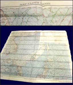
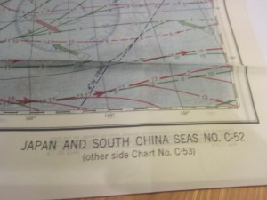
 World War II United States Army Air Force escape survival map, found tucked away in storage in as-new condition.
- Feels very silky, but it likely is rayon acetate.
- Two sided map: C-52 includes Japan and South China Seas. C-53 includes East China Sea.
- Shows winds and currents.
- Background information: During WW II airmen were provided with “Escape and Evasion” maps for use if shot down behind enemy lines. In the Pacific theater, crews flying over vast bodies of open water carried ocean current and prevailing wind “drift” maps if isolated on a life raft.

- Green lines represent direction of currents from May through September; red lines from November through March.
- Easily hidden, could endure harsh weather, would not disintegrate in water, and could be used quietly.
- Folds compactly down.
Extremely fine version of this collectible. This WWII Escape Survival Map is available in our eBay Store Connectibles.
